

Cadastral map digitization
A parcel of land drawn by hand in the 1960s becomes a record you can find on a map today
DesiCrew converts the Netherlands' old hand-drawn cadastral maps into digital land records — tracing every boundary, capturing every parcel and building number, and linking each one to its exact position.
4 min read
For this client, DesiCrew converts the Netherlands' old hand-drawn cadastral maps into digital land records — tracing every boundary, capturing every parcel and building number, and linking each one to its exact position.
The source is a hand-drawn Dutch map, sometimes sixty years old and faded. The output is a clean digital parcel — its lines, numbers, buildings and symbols all captured and tied to the right location. No tool can read a smudged 1960s figure reliably, so a person traces and verifies every one. So a land record that only ever existed on paper becomes something anyone can find on a map.
01 — The Mandate
The company digitizes the Netherlands' cadastral records — the official register of land parcels and buildings. DesiCrew does the conversion: taking each old paper map and rebuilding it inside the digital cadastral system.
- What a cadastral map holds. Think of a stripped-back digital map: parcel numbers, land numbers and building numbers tied to location, and little else — ultimately linked to a map anyone can navigate by location.
- From paper to digital. The inputs are old, hand-drawn maps of Dutch cities, many from the 1960s; each is rebuilt as a digital record so exact parcels and buildings can be located in future.
- Manual by design. Work isn't auto-assigned — the client pushes images to the tool, batches are aligned to annotators by hand, and each person works their own set of maps.
- Inside the client's tool. Everything happens on the company's own platform; the data belongs to the land registry and can't be downloaded or kept, so it is viewed and worked in place from start to finish.
02 — The Challenge
The hardest part isn't drawing the map. It's reading it. These are hand-drawn maps, some more than sixty years old and faded. A single digit can be hard to make out, and a misread number is a misplaced parcel. No tool can reliably read a smudged 1960s figure — which is why every line and number is traced and verified by a person.
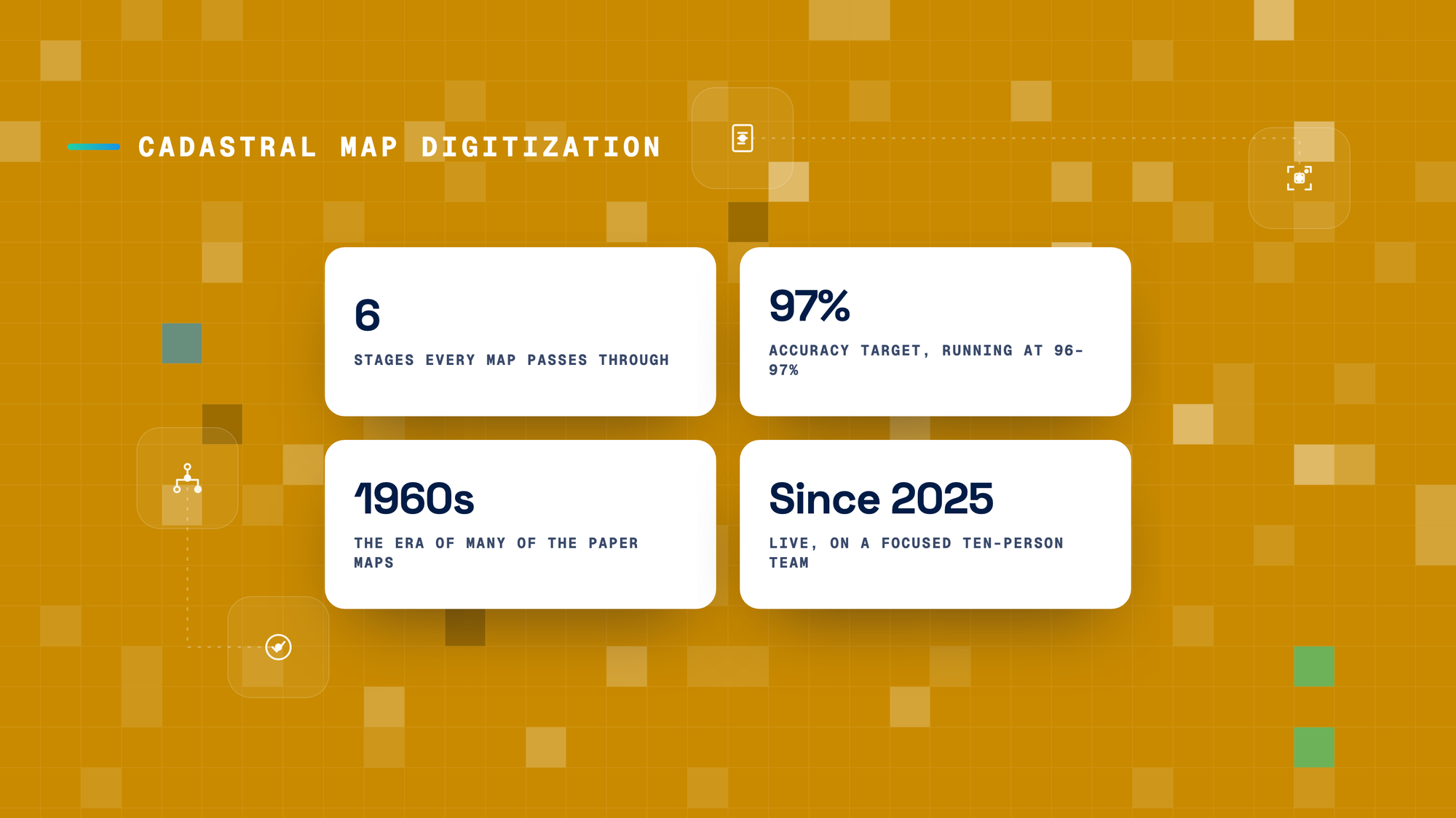
- Sixty-year-old handwriting. Some maps are clear; others are older and faded. The recurring issue is simply reading the handwritten numbers, where two readers can land on different figures — the main gap that keeps accuracy at 96 rather than 97.
- One line, two parcels. Where neighbouring maps overlap, the same boundary can appear on both; each line has to be attributed to the correct parcel during the work, or it becomes a boundary clash later.
- A different language. The maps are in Dutch. Only the numbers matter for the record; where wording needs checking, it is translated as required.
- Nothing leaves the tool. The land data can't be downloaded or exported — so there's no shortcut of pulling it into an outside AI tool. It is read and worked entirely inside the client's platform.
03 — The Approach
Every map moves through six manual stages before it's linked to position and pushed — then checked again.
- Line correction. Every line drawn on the map is traced and annotated by hand.
- Text boxes. A box is marked manually around each number in the sketch.
- Text reproduction. The numbers inside those boxes are captured and highlighted.
- Cadastral correction. Overlaps with neighbouring maps are checked and resolved, so each line is attributed to the right parcel and future boundary clashes are avoided.
- Building correction. Every building is captured with its own individual number.
- Symbol collection. The map's symbols — boundary stones, markers and figures — are captured too.
- Position, push and QC. Only once all six stages are done is the map linked from paper to its position on the cadastral map and pushed. A team member then quality-checks it: once every map was reviewed at 100%; today QC samples at random against a 97% target, with the client running its own random audits on top.
04 — The Outcome
- A map you can actually search. Each hand-drawn parcel becomes a digital record — its lines, numbers, buildings and symbols captured and linked to position — so a record that lived on paper can be found by location.
- Overlaps resolved before they clash. Attributing every shared line to the right parcel during correction heads off boundary disputes down the line — so the digitized record holds up, not just looks complete.
- 97% accuracy, independently audited. Random-sample QC against a 97% target, with the client's own random audits on top, keeps the output reliable at scale — so the client can trust the record without re-checking every map.
05 — Why the relationship holds
This is a young program — live since 2025, about a year in — run by a focused team of ten. It is precise, manual work, and the standard already sits at 96–97%.
The value is judgment a machine can't supply: reading faded sixty-year-old handwriting, resolving overlapping boundaries, and getting a number right when it is genuinely ambiguous. And because the data never leaves the client's tool, the work depends on a partner who can deliver accuracy inside the client's own secure environment — which is exactly the discipline DesiCrew is built for.
About DesiCrew
DesiCrew is an applied-intelligence company — the human and technology layer that makes AI systems and enterprise operations work reliably and grow at scale, refined in production since 2007.


Let's put intelligence to work.
If your AI keeps breaking when it leaves the lab, or your operations are carrying weight AI should be taking off — let's build together.