

Data annotation & enrichment
Labeling the world for the largest provider of search engines since 2008, from maps to autonomous drones
This company carries the world's geography for billions of people. DesiCrew has enriched that map across 70 countries since 2008, and now labels the aerial imagery, loaders and landing pads that train the company's autonomous delivery drones.
5 min read
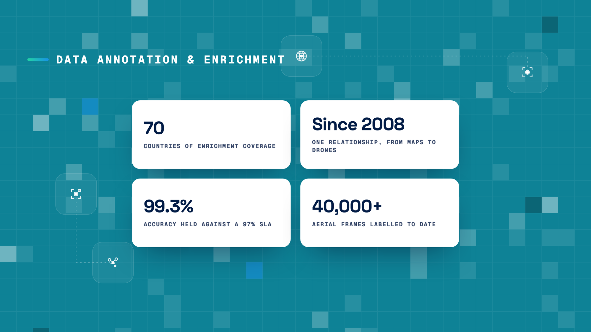
This company carries the world's geography for billions of people. DesiCrew has enriched that map across 70 countries since 2008, and now labels the aerial imagery, loaders and landing pads that train the company's autonomous delivery drones.
A drone that delivers with no one on the controls has to trust what it sees. DesiCrew labels every frame it learns from, by hand, inside the client's own environment. So a map billions rely on stays right, and a drone knows the ground it is about to land on.
01 — The Mandate
The company builds products that read the physical world, and those products are only as good as the labels underneath them. DesiCrew produces those labels, and has done so since 2008.
- Scale. Enrichment across 70 countries, and on the drone program a team that ramped from 13 people to around 100 at peak, with 40,000+ aerial frames labeled to date.
- Coverage. The client supplies the bulk of the raw imagery; DesiCrew adds the structure that makes it usable — the classes, the boxes and the key points a model can learn from.
- Two lines of work. Enrichment on aerial and satellite imagery, and drone annotation across three types: semantic segmentation, 2D bounding boxes, and key-point annotation.
- Always on. Two overlapping shifts, day and night, for a US-based program, with the same team flexing across both so nothing waits on a timezone.
02 — The Challenge
Labeling the pixels is the easy part. Deciding what an autonomous drone can trust is the hard part. A drone that delivers on its own has no one to correct it in the air — it flies on what it learned from labeled imagery. Mark a tree as open ground, or a charge pad as free when a drone is already on it, and the model learns something false about real airspace. The program has not launched yet, so every frame labeled now is what the first flights will trust.
- One frame is not one label. Each aerial frame is segmented into around 20 classes — vehicles, buildings, roads, vegetation and more — every visible part of the scene marked so the drone can read an environment it has never seen.
- The same object, every environment. There is one auto loader, but it has to be annotated in every setting it appears in, because the surroundings change even when the object does not — bounding boxes and key points, flagged occupied or free, frame by frame.
- The error does not show until it flies. A mislabelled frame is not a visible mistake today; it is a wrong assumption baked into a drone that will one day act on it, with no human in the loop.
- Nothing can be automated away. The work runs entirely inside the platform's own tool, on company-issued machines, with no login from DesiCrew systems. There is no room to build a shortcut — the accuracy has to come from the people.
Anatomy of one frame — why the drone cannot label it itself
One aerial frame carries around 20 classes — every vehicle, building, road and patch of vegetation marked, plus the loaders and charge pads the drone will use, each boxed, key-pointed and flagged occupied or free. The model reads the image. It cannot decide what it means. Whether a surface is safe to land on, whether a pad is free or taken, whether a shape is an obstacle or open ground — these are judgments the drone inherits from the label.
03 — The Approach
DesiCrew labels every frame by hand, inside the platform's locked environment, and holds the standard from day one.
- Work inside the walls. Everything runs on the company's own tool, with no access from DesiCrew systems; the team is trained on the platform and works only there.
- Map the environment. Semantic segmentation of aerial imagery into around 20 classes, so the drone can read a scene and deliver into empty space with no human guiding it.
- Mark the loader and the pad. Bounding boxes and key-point annotation on the auto loaders and charge pads, flagged occupied or free, in every environment the drone will meet.
- Two shifts, no waiting. Async work across two overlapping shifts, day and night, so a US-based program never loses a timezone.
- Quality from the first day. A 97% quality SLA, held at 99.3% from day one and maintained since, through DesiCrew's own QC before anything reaches the client's review.
04 — The Outcome
- A map billions can trust. Enrichment across 70 countries keeps the geography accurate for the people who depend on it every day.
- A drone that knows the ground. 40,000+ frames labeled at 99.3% accuracy give the autonomous delivery program training data it can trust before the first flight — so the drone learns the world correctly the first time, not after a failure.
- Proof of what DesiCrew can hold. A 97% SLA beaten from day one and held since, inside the locked environment, across day and night shifts — so the client keeps handing DesiCrew its most controlled and most frontier work.
05 — Why the relationship holds
DesiCrew began labeling for this client in 2008, on map enrichment. The relationship grew from mapping the world to training the machines that will move through it.
The accuracy is the other half. A 97% standard, held at 99.3% from the first day and never let slip, across two shifts and a ramp from 13 people to 100 and back. Quality that does not move is why the next program keeps coming to the same place.
About DesiCrew
DesiCrew is an applied-intelligence company — the human and technology layer that makes AI systems and enterprise operations work reliably and grow at scale, refined in production since 2007.


Let's put intelligence to work.
If your AI keeps breaking when it leaves the lab, or your operations are carrying weight AI should be taking off — let's build together.